

*CAA PfCO / 20170912 Greywolf Studios Limited Privacy notice & statement


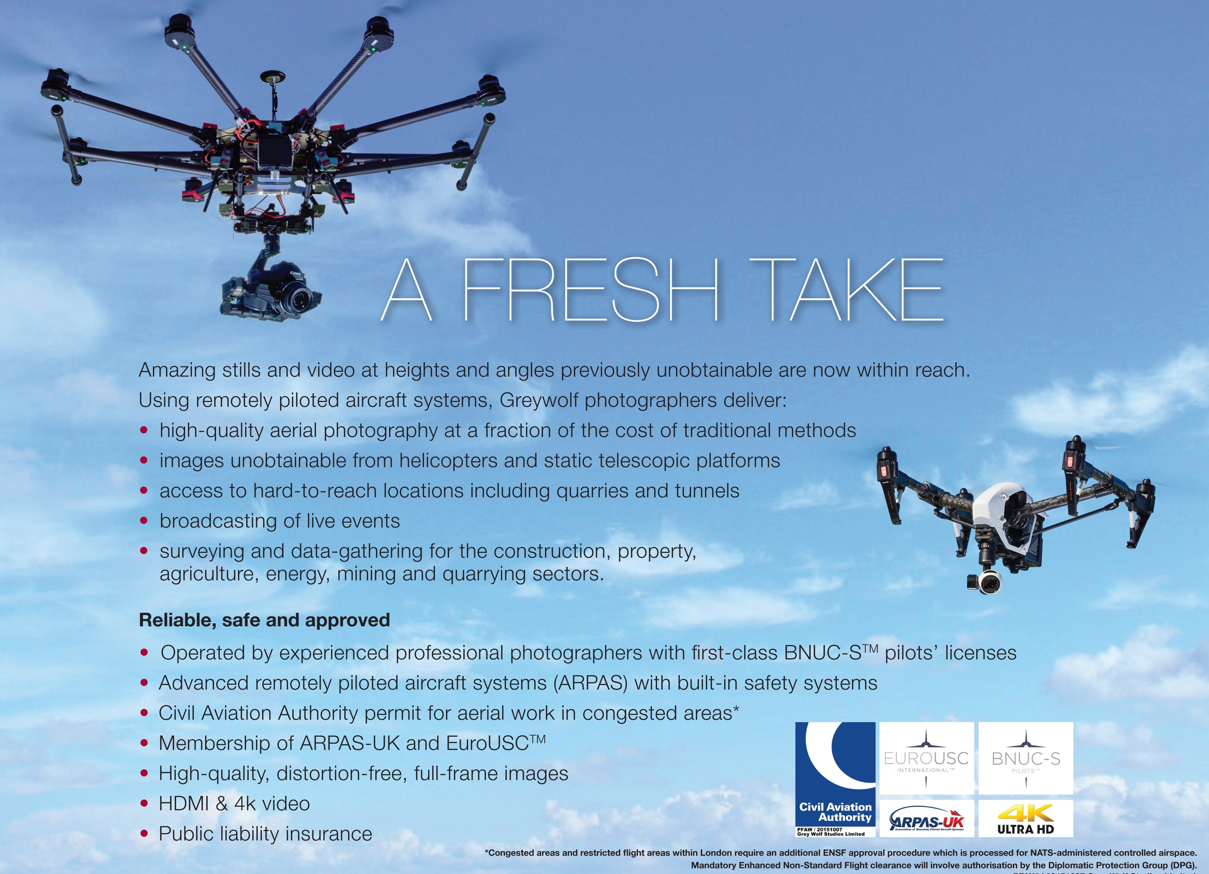
GREYWOLF AERIaL VIDEOS

Greywolf aerial photography showreel

Honda marine Roma, Italy 2018
Honda marine Italy 2018

360º imaging
Greywolf Studios now using DJI's latest mapping software and equipment..
GS Pro or Ground Station Pro can plan complex flight missions with just a few taps while automatically taking pictures at pre-set waypoints, providing the accuracy required for precision mapping. Watch how the new virtual fence feature increases safety and ease of use by locking the aircraft's height and speed within a designated area.
This new software plans complex flight missions whilst automatically taking pictures at pre-set waypoints, providing the accuracy required for precision mapping. The new virtual fence feature increases safety by locking the aircraft's height and speed within a designated area. Please see the examples below and how the applications may be used within your projects..


